Live GPS · Map · HUD Privacy-first
FlightNav GPS
Your onboard flight tracker
Real-time GPS tracking with map, route, logging, replay and export.
Not certified for operational aeronautical navigation. FlightNav GPS is not a certified instrument. Always follow approved procedures and use approved equipment.
Milan → Rome · sample track
Features
Everything you need, nothing you don’t
High-contrast dark UI built for cockpit readability and fast touch controls.
In the air
Map, numbers and route while you fly
- Live GPS flight trackingReal-time map with aircraft and follow mode. Clear, readable indicators.
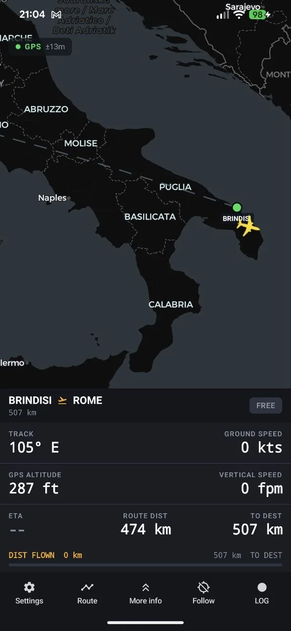
- Flight Info HUDGround speed, GPS altitude, track, vertical speed, fix status and accuracy.
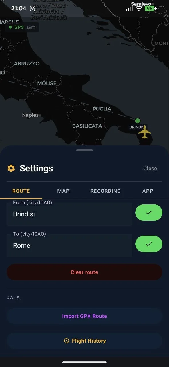
- Route planningSet From/To (city/ICAO) and add waypoints with a long-press on the map.
On the ground
Record, review, export
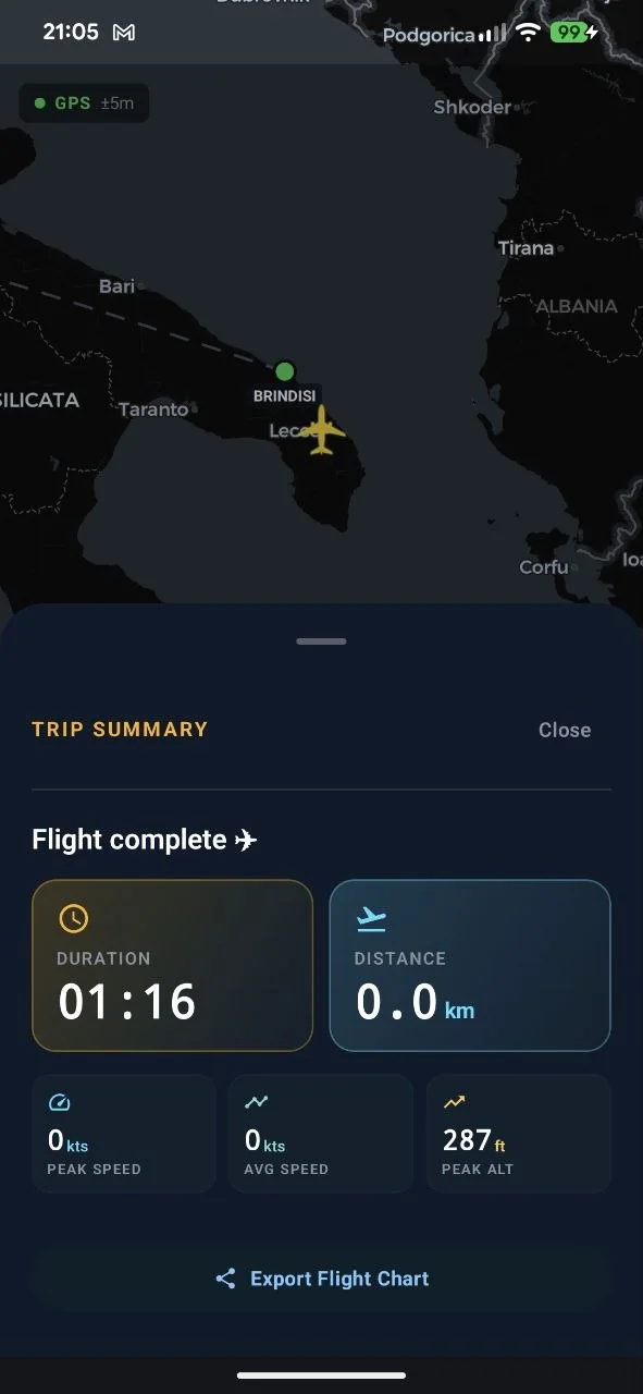
- Logging and replayRecord flight points, review the track and analyse your route. Once the engines are off you get the summary: duration, distance, peak altitude and the altitude profile.
- GPX / KML exportExport your tracks to share them or load them into other tools.
Out of coverage
Everything you need stays on the phone
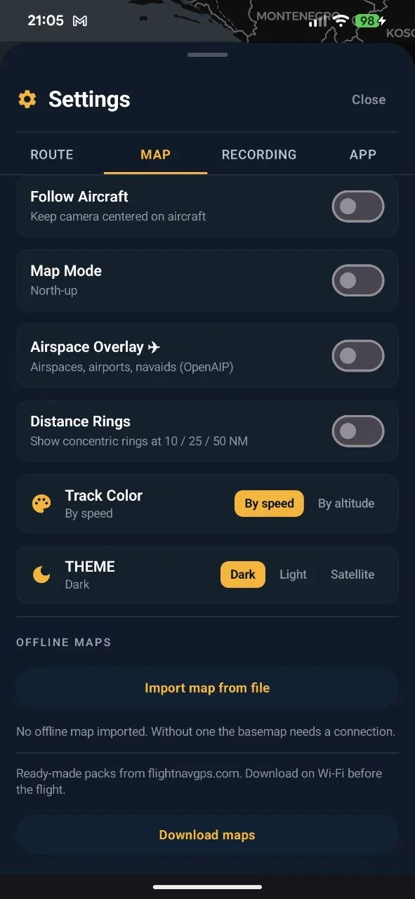
- Offline mapsDownload a ready-made map from the site or from the app, or import your own .mbtiles file. In flight the map draws from the phone, with no connection.
- Airports and cities on board1,800 airports and 2,700 cities inside the app, searchable in airplane mode too.
- Last known positionWith no signal the aircraft stays on the last position actually recorded, dimmed and clearly labelled: nothing is estimated.
Questions
Frequently asked
Does it work without a connection?
Yes. GPS needs no network and, with an offline map imported, the map draws itself as well. Only place search by name and map downloads need a connection.
Is the speed shown IAS?
No, it is ground speed. IAS needs a pitot tube and a static port: GPS cannot give it to you. In cruise with a tailwind the two can differ by 50 knots.
In the cabin I see poor accuracy, or empty values
That is normal in a pressurised cabin: the fuselage weakens the signal and the phone struggles to lock onto satellites. Move closer to a window and check that location is on and set to its most accurate mode in Android settings.
Do my flights end up on a server?
No. Recordings, exports and maps stay on the phone. The only request that leaves is a place search, which sends the text you typed, not your position.
Can I use my own maps?
Yes. Besides the ready-made packs, the app imports raster .mbtiles archives. Under Settings ▸ Map you pick which one to use, switch it off without deleting it, or remove it to free space.
How much does it cost?
Nothing. No subscription, no ads, no in-app purchases. Not even an account to create.
Before your next flight
Get the app, then the map
Free, no account, no ads. To report a problem, write to me with your phone model and app version: I answer within 24–48 hours.
Support
If something is wrong
Write to me and attach a screenshot, your phone model and the app version, which you find under Settings ▸ App ▸ Information. With those three things a problem takes one email instead of five.